Introduction
to Geological Sciences
Understanding Contouring
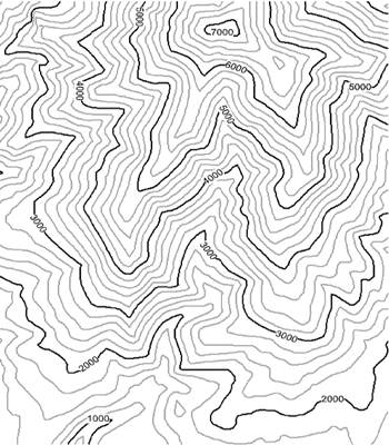
Contouring and contour maps are one of the most fundamental tools in geology. Contours provide a clear representation of the variations in the land surface. Among their many uses, contour maps are extremely valuable when analyzing the potential for mass movement, since slope is a major factor.
In this lab, you will construct contour lines on the actual land surface so it becomes quite clear exactly what contours mean. You will be places in a team of approximately six individuals. Contained within the team will be 3 groups of approximately two. You will need the following:
- pencil and paper
- string
- stakes
- a meter stick with level
- compass
Procedure:
- Each team will be assigned a location. Each group will construct one of three contour lines. The instructor will indicate the starting point for each group as well as the direction in which to proceed.
- Ultimately your job is to construct a line, using string, where the ground surface is at the same elevation as the starting peg. Beginning with the starting peg, use the level to find a point at the same level, 1 meter away. Push down so that the grass does not become a factor; get as close to the ground surface as possible. Once you have found this point. Place a new peg there.
- Continue this process until you have emplaced 15 pegs (which should be 15 meters. Survey the placement of the pegs visually and look for any obvious errors. Walk along the line of pegs. Your elevation should not change.
- Once you are convinced of the accuracy, take the string and tie one end at the starting peg. Then, stretch the string to each of the succeeding pegs, wrapping the string once or twice around each peg. Continue this until you reach the last peg.
- Survey your line again to check for obvious errors. Re-measure and correct if necessary. A good way to check is to get down on the ground surface and visually inspect vertical distances between the lines; they should not vary.
- Once the entire team is finished, carefully and neatly draw a map of the lines as they would appear looking straight down from above. Include features of the surrounding area as references. Give your map a title, date, north arrow, and contour interval.
- Respond to the following:
- Your lines may be curvy, straight, or both. Describe what factors determine the curviness of your contour lines?
- The distances between neighboring lines may vary. Describe what is different about the land surface when the lines get closer together and farther apart.
- Describe how the contour lines reveal the character of the land surface.
- Once your group is finished with your site, do not disassemble yet. Visit the other two sites and draw two additional maps just as you did with your own site. For each site, after the map has been draw, conduct an analysis with your group members. Specifically look for unique or unusual characteristics of the land surface. Describe these.
- When all groups are done, return to your original site and remove the pegs and string. Return all equipment to the classroom.
- Write a one paragraph reflection on this activity. Specifically address how the activity affected you understanding of contours.