GEOL 101 – Introduction to
Geological Sciences
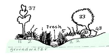
North Creek Hydrology Laboratory
The care of rivers is not a question of rivers,
but of the human heart,
-- Tanaka Shozo
In this laboratory you will venture into the field to collect data on the hydrology of North Creek. Before you continue, make sure you have familiarized yourself with the handout describing the wetland restoration project. Outcomes for this lab are as follows. Students will:
- Actively gather data on stream sedimentation, stream velocity, and stream morphology
- Communicate among group members in an effective way in order to gather a full suite of accurate data
- Examine the data critically in order to extrapolate relationships among sediment grain size, velocity, and the shape of the channel
- Function effectively within a group and under the unique demands of the field in order to complete the operation
- Discuss with group members the overall conclusions
- Prepare a complete report of findings and conclusions
You will be assigned to a group that will work together at a particular point along the stream. There will also be two independent teams moving from group to group conducting stream velocity measurements.
When in the wetland area, be aware at all times not to excessively disturb any plants, animals, or physical components of the project.
Part
1. Field Investigation.
Each group will need the following:
- a notebook to record data and pencil
- hip waders
- grain size charts
- graph paper
- meter stick
- ruler
- string
- (2) stakes
- a permanent marker
The roving velocity teams will need velocity meters.
Each transect group will have approximately six members. Four will be the grain size task team (2 gatherers, 1 analyzer, & 1 recorder), the other two will be the depth task team (1 measurer, 1 recorder)
Upon arriving at the study location and being assigned a specific location, complete the following:
- Record, detail, the general physical nature of the location and a current weather conditions. Carefully note anything unusual. Draw pictures as appropriate.
- Each group will plant a stake on the bank and another directly across the stream. Be sure the stakes are firmly planted. Extend a piece of string from one stake to the other. The string delineates a transect. Use a measuring tape or meter stick to mark off 2-decimeter segments on the string. Number the increments from west to east.
- For the following task team assignments, be creative and efficient in dividing up the work. Make every attempt to divide the workload equitably. Maintain open communication among all group members at all times.
- The grain size task team will take small but representative samples from the stream bed directly beneath each increment. Samples should be placed in the appropriately numbered baggy and handed to the grain size recorders. The grain size recorders will then record grain sizes using the grain size chart for each numbered location. In addition, note any biological material encountered at each location (grass, worms, etc.)
- The depth task team will measure depth
from the string to the streambed at 2-decimeter intervals. Be certain that the string is tied to
the base of each stake, and that the meter stick is perfectly vertical
when measuring depth. Report values
to the recorder for each location. Measure depth from the stream surface to the stream bottom.
- Sketch a map of the segment of the stream you are working on. Include the shape of the stream within 20 meters of your transect, any barriers, reference points, and stream features.
- The stream velocity teams will use stream flow meters to measure velocities at locations along the transect. One location must be the center of the stream, and each successive location will at six decimeter intervals in each direction from center. Be sure no one is immediately upstream from you as you measure velocity. Always stand to one side of the flow meter. Once velocity has stabilized at each location, report the value to the recorder and move to the next point.
- When all teams are finished, assemble all material. Leave nothing behind. All equipment should be relatively clean. Return to the lab.
Upon return to the lab, rinse, clean, and replace all materials. When this is completed, continue with the following:
Part
2. Data Compilation and Analysis.
- Each group should share all data gathered by the task teams. Every individual should have a complete record of the data.
- New teams (within each group) should then form comprising 1-2 individuals from each task team and work collaboratively to complete steps 3-
- Each person will construct a labeled stream profile using graph paper and all the collected data. You will also be constructing a velocity graph on the same page, above the transect. Do not use Excel.
- It is best for all teams to use the same x and y-axis scales, since you will eventually be comparing all three data sets. Determine this as a class first. There should be a vertical scale and a horizontal scale for the profile. The length (horizontal) should be the length of your transect. The vertical should be the maximum depth of the stream. Mark off 1-dm segments along the horizontal. Place a dot for each 1-dm location indicating the depth of the stream. When completed, connect the dots with a ruler to create the profile.
- Label the profile with grain sizes and stream velocities. You may use color.
- Label the axes of the profile and include units. Give your profile an appropriate title.
- Construct a graph of velocities directly above the profile so you can make visual correlations.
Finally, you will provide a formal, written statement of findings and conclusions. Findings are the actual data and interpretations; conclusions are the “big picture” generalizations. Consider the following when writing this final statement:
- Are there relationships between stream velocity, grain size, and depth?
- Do certain organisms prefer certain locations along the transect? Why?
- Does the shape of your transect relate to its location along the stream? How?
- Are there any conclusions from your transect that can be extrapolated to streams in general?
This is a portfolio entry. Include the profile, location of profile on stream map, and final statement.